


Arran - much more than just Scotland in miniature
- Nov 3, 2014
- 9 min read
FOR many of us there is a place, a particular spot in this lovely land, that we can forever associate with a life-changing experience. For me that place is the island of Arran. It was here, only a dozen miles or so from the Ayrshire coast, that I decided to dedicate the rest of my life to climbing mountains and exploring wild places.
It was after negotiating the narrow and spectacular ridge between Beinn Tarsuinn and Cir Mhor – the finest ridge in Scotland outside the Skye Cuillin – that I made that fateful decision. It was 1969 on a sun-soaked day and I had been thrilled by the tight and exposed crags and ridges – over Beinn Tarsuinn and the A-Chir ridge onto the narrow summit of Cir Mhor. My companions and I had spent too long on the sun-kissed granite and so we had to jog down the hill to catch the evening ferry at Brodick.
As we loped down the hillside, exhilarated by our achievements, I made the decision that somehow I was going to spend the rest of my life amongst mountains. Ever since then the hills of Arran have been a bit special.
I’ve lost count of how many times I’ve visited Arran since, but I know it’s not enough. Too many years passed while I was exploring other parts of Scotland and when I did return it was as a seasoned and experienced mountain addict. But by that time I was interested in more than just bagging peaks. I quickly realised that Arran, this island that many suggest is ‘Scotland in miniature,’ has much, much more to offer.
Arran is steeped in myths and legends, some of them associated with smuggling, others with the saints and sinners, kings and lords who visited the island long before us, even as far back as Bronze Age times.
The legends surrounding the Cat Stone at Corrie, the story of Robert the Bruce hiding from the English forces at King’s Cave and the history of Arran’s whisky industry can all be experienced on a long walk around Arran’s coastline.
Back in 2003 I was invited to open a new long distance trail, the Isle of Arran Coastal Way, and spend a few days walking sections of the route. While the mountains of Arran have always attracted climbers and hill-walkers many folk are a little over-awed by the steep and narrow ridges of the island’s main peaks. For every climber who has been thrilled by the sweeping granite slabs and the steep, soaring pinnacles of the likes of Cir Mhor and Casteal Abhail there are dozens of walkers who would rather tackle something less dramatic, less taxing, but challenging enough to make their outing an adventure. And so the 65-mile Isle of Arran Coastal Way was conceived by two local men, Hugh McKerrell and Dick Sim.
The coastal route can be treated in a number of different ways. Diehard backpackers can wander round the island carrying a tent, sleeping bag and everything else needed for survival, dossing down in one of the island’s many caves or bivouacking below the night skies. Others might prefer a little more comfort, spending the nights in a guest house or hotel. Others again might prefer to walk the route over a number of weekends, tackling one or two sections between villages each time.
Arran has, in a sense, been ideally created for coastal path walking. A raised beach, like a shallow coastal fringe, encircles the island, even below the steeper cliffs of the island, and the Coastal Way follows this raised beach virtually all the way. While much of the route follows well used footpaths and stretches of beach here and there you have to follow the road, albeit a very quiet and pleasant road, mostly on the west of the island.
My own favourite section was probably the toughest part of the route, from Kildonan to Whiting Bay past Dippen Head. No footpath tames this part of the walk, although the difficulties can be avoided by following the road at the top of the cliffs. With steep 300ft cliffs on one side and the open sea on the other this part of the coastal fringe is an enormous boulderfield, and some of the boulders are the size of a double-decker bus.
The route passes the Black Cave, the largest cave on the island, and although great care is required as you leap from rock to rock there is something rather satisfying in the uncompromising nature of the terrain that made me, essentially a mountaineer, feel very much at home.
Rocky reefs run out towards the little lighthouse island of Pladda, and beyond, floating on the horizon, is the great plug of Ailsa Craig. It isn’t hard to believe that these parts have seen regular encounters between excisemen and smugglers over the years – the contraband trade once thrived well on these south shores of Arran.
Just recently the Arran Access Trust, who have inherited management of the Arran Coastal Way, secured a Coastal Communities Fund grant to upgrade the Arran Coastal Way. One of the aims is to meet the criteria to be accepted as one of ‘Scotland’s Great Trails’, as well as improving and promoting walkers’ experiences on Arran. The work will last about two years.
I suspect archeologists and geologists feel pretty much at home on Arran too for this island is a living archive. A nineteenth century geologist once wrote: “The number of rock formations, sedimentary and plutonic, which are found within this limited space is truly remarkable, perhaps unparalleled in any tract of like extent on the surface of the globe.”
Most of the mountainous northern half of the island has been formed by a large granite core, created by volcanic activity around 60 million years ago. Sedimentary rocks dominate the southern half of the island, especially Old and New Red Sandstone.
On the Coastal Way, as you approach Lochranza from the Cock of Arran, you’ll come across a coastal feature known as Hutton’s Uncomformity. Visiting Arran in 1787, the geologist James Hutton found his first example of an unconformity, which provided evidence for his theories about the age of the Earth. At that time the common view was that the Earth was about 10,000 years old but Hutton discovered adjoining layers of rocks that appeared to have been created at different times, and by different sources. This led him to believe that the Earth was not 10,000 year old but much, much older, possibly many millions of years old. This site on Arran is one of the best known places in the study of geology.
Just off the shores of Lamlash Bay lies a smaller island, home to a community that has embraced a somewhat different, older culture. A tiny ferry had whisked me across the bay to Holy Island, just off Arran’s south-east coast and a line of glistening white chortens and fluttering multi-coloured prayer flags led up the grassy slopes to the whitewashed Centre for World Peace and Health’
Holy Island is run as a centre for wisdom and learning within the Karma Kagyu tradition of Tibetan Buddhism and is open to people of all faiths and none, but that’s not why it’s called Holy Island. The place has a spiritual heritage that stretches back to the 6th century. The earliest recorded name for the island was Inis Shroin, or island of the water spirit, but when the Celtic missionary who became known as St Molaise lived on the island at the end of the 6th century, the place was named after him. During the early part of the 19thcentury the island gradually became known as Holy Island.
The highest point on the island is only 314 metres on Mullach Mor and that was where we were heading, through a gateway of prayer flags, up the edge of a tilting field, over a style and along a rutted footpath through a recently planted native woodland area. When we came out of the trees all the big hills of Arran were visible to the north across the shimmering waters of Lamlash Bay.
The island has two hill-tops, and it was now a steep climb to the first of them, Mullach Beag. As I climbed I realised it’s no wonder that ancient monks and contemporary lamas have chosen this island as their place of meditation and prayer, for the natural beauty of the place heightens the senses and brings you full face against the whole glory of creation, whatever your religious leanings, although I suspect the beliefs of St Molaise and the current leader of the community here, Lama Yeshe, are not as far apart as people might assume.
A steep descent from Mullach Beag is followed by an even steeper climb to the main summit, Mullach Mor and its from there that you can appreciate the full glory of the surrounding views. To the east the hills of Ayrshire are low-lying but closer at hand, beyond a green and yellow patchwork of fields, lie the rugged hills of Arran. And at your feet, across the peaceful waters of the bay, lie the houses and buildings of Lamlash, white and glistening in the sun, strung out round the gentle curve of the bay.
The descent from Mulloch Mor is badly eroded and steep. The community say plans are in hand to repair the path and that’s good, because of the rest of the walk, down to lighthouse which now forms the Inner Light Retreat for women and back up the west coast of the island, is quite beautiful.
As we made our way along the grassy track that runs up the west of the island, we passed a number of colourful rock paintings that depict different deities and teachers of the Kagyu Lineage of Tibetan Buddhism: White Tara, Green Tara, Milarepa, Marpa, Gampopa, Buddha Shakyamuni and Dusum Khyenpa. And close by the rock paintings lie another feature of the island, the Holy Well and cave of St Molaise.
The cave is indicated with a little sign pointing up some steps, and just beyond it bubbles the well where, for centuries, people have come to drink the water in the hope of being healed from whatever ailments they were suffering from. I lapped some myself, and it was cold and crystal clear, although it doesn’t apparently meet current EU standards!
We made our way back to the Centre for World Peace and Health where a Centre volunteer profusely apologised for not being able to make us tea or coffee before the next ferry arrived. We just had time for a quick exploration of the Centre’s organic garden before we were whisked off the island again and back to Lamlash. We left a quite different world behind us…
In 1628 the Duke of Montrose entertained the traveller William Lithgow at Brodick Castle on the Isle of Arran. Lithgow, known as Lugless Willie on account of his deafness may have been hard of hearing but there was nothing wrong with his eyesight. During his stay with the noble duke he climbed Goat Fell, the highest mountain on the island. Formerly known as Goatfield Hill Lithgow later wrote in appreciation of the experience.
“A larger prospect no Mountaine in the world can show, pointing out three Kingdomes at one sight: Neither any like Ile or braver Gentry, for good Archers, and hill-hovering Hunters.” Lugless Willie may have been deaf but there was little wrong with his eyesight if he managed to see Scotland, Ireland and England!
One old guidebook suggests the views from Goat Fell are “laid out like a geography lesson,” with the Firth of Clyde spread out in a shimmer of blue. Beyond lies the Ayrshire coast, running all the way down to the Rhinns of Galloway and up towards the opening of Loch Long. Dotted on the Firth below lies the Cumbraes and the Isle of Bute. The small island off the west coast of Bute is Inchmarnock, once known as the “drunk man’s island.” Drunkards who persistently offended against Bute’s laws of sobriety were banished there to serve a term of punishment!
The best views are to the rest of this remarkable island. To the west of Goat Fell, across the deep gulf formed by Glen Rosa, the rocky ridge of Ben Chliabhain climaxes in the vertiginous slopes of Coire Daingean which, in turn, is joined to Cir Mhor by the great buttress of A’Chir. Beyond it protudes the stump of Caisteal Abhail and the north ridge of Glen Sannox. Beyond Beinn Chliabhain the great prow of Beinn Nuis soars above the serrated ridge that runs out to Beinn Tarsuinn.
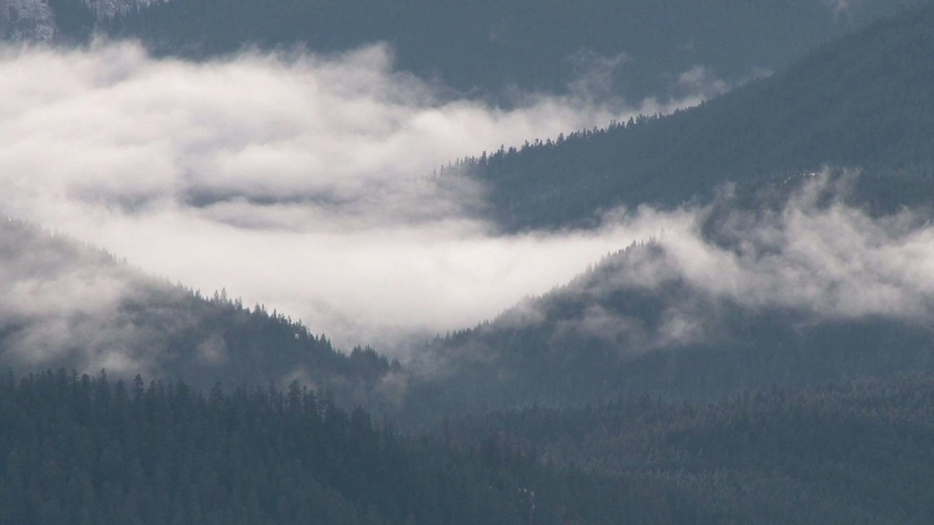
Only once in several visits have I enjoyed this view, and it remains imprinted on my memory. The Isle of Arran has this curious, and frustrating, habit of wearing a cap of cloud. When all the low lying areas have a blue, cloud free sky smiling down on them the mountain peaks lie smothered in their own little weather system.
Some recent plans for a weekend of ridge wandering and scrambling were dashed by heavy rain and low cloud so instead of tip-toeing delicately across the sun-warmed slabs and narrow ridges of A’Chir and Cir Mhor we opted for a plod in the rain up Goat Fell.
I felt a little guilty for treating Goat Fell in this way, as though it’s inferior, but it is a bit of a tourist romp up the well-maintained footpath. Although the hill would grace any highland region and offers a serious enough challenge, it is the easiest to climb of all Arran’s peaks.
Although it was still wet and cloudy on the summit we ate a quick lunch and, ever the optimists, pushed on towards North Goat Fell over the granite buttresses and spires of the little ridge that’s known locally as the Stacach. Tracings of paths run round the sides ofthese little turrets but we opted to climb them, before realising that weeks of rain had turned the normally rough and reliable Arran granite into boiler plates of greasy slime.
North Goat Fell couldn’t come quickly enough and we escaped down the steep and well worn ridge that leads to The Saddle between the heads of Glen Sannox and Glen Rosa. Ahead of us the precipitous slopes of Cir Mhor rose into the gloom but we decided to leave its ascent for another day. The long path down Glen Rosa led to the pub, dry clothes and plans to return to Arran’s delectable mountains as soon as we possibly could.


Comments