


The Affric Kintail Way - put it on your to-do list!
- Sep 23, 2015
- 8 min read

In Glen Lichd on the Affric Kintail Way
THERE are certain Scottish place names that evoke in me all kinds of expectation and excitement. Torridon is a good example, but there are other names that stir me in the same way. Two of them are Affric and Kintail.
I remember as a young novice hillwalker reading an article in the Scots Magazine by Hamish Brown who titled his piece as The Gates of Affric. I seem to recall he was describing the walks from those portals of Glen Affric, Cluanie and Morvich, but there was something in the title of that feature that sounded rather exotic and mysterious to my young ears.
Likewise, when I think of the name Kintail I have visions of long, narrow mountain ridges - like the South Glen Shiel ridge or the Five Sisters - deep glens and steep craggy hillsides. I think of the way Glen Shiel drops down towards Loch Duich at Shiel Bridge, with massive mountain slopes on either side, some of the steepest in the country. Both placenames offer a hint of magic, anticipation and exhilaration.
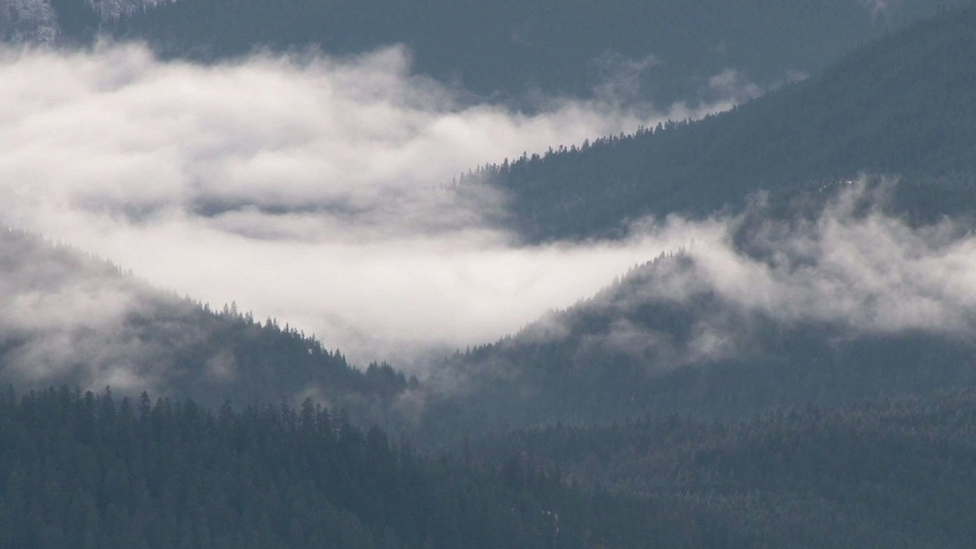
Earlier this year I had the privilege of officially opening a brand new walking route that runs through the heart of both Affric and Kintail. Originally it was to be known as the North Highlands Way but I’m delighted the name was changed to incorporate two of the most stimulating place names in Scotland.
Starting in Drumnadrochit on Ness-side the route climbs gradually through Glen Urquhart into Strathglass at Cannich then meanders through the magnificent pinewoods by Loch Beinn a’Mheadhoin and Loch Affric before crossing the watershed and dropping down through Kintail to Gleann Lichd and the finish at Morvich near Shiel Bridge.
It’s a route that people hike regularly, but it’s now signposted, has its very own dedicated Harveys Map and website and will be the subject of a big push to encourage people to walk it and in doing so bring some welcome tourism trade to places like Drumnadrochit, Cannich and Shiel Bridge.

The opening of the route was described to me as the ‘culmination of a dream’ for local man Ian Mure. Ian is chair of the Strathglass Marketing Group and he told me the project has seen the successful partnership of a number of organisations, including Forestry Commission Scotland, the National Trust for Scotland and Glen Urquhart Community Council.
Strathglass Marketing Group was established in 2001 in the wake of the foot and mouth epidemic that had serious implications for tourism based businesses throughout the UK. Today, the aim of the group is to promote the Glen Affric and Strathglass area, including the surrounding glens, in order to maximise business and tourism-related income and employment opportunities within the local community. The idea behind the creation of the AKW was to simply promote an area of outstanding natural beauty to a wider visitors market.
“By extending the already popular trek through Glen Affric to the west via existing forest paths along Glen Urquhart to Drumnadrochit walkers have the added option of extending the AKW to or from either Inverness or even Fort William,” Ian Mure told me.
“Walking and cycling are becoming an ever more popular way of keeping fit and enjoying the great outdoors with the market expanding exponentially,” he said. “Walkers and cyclists are looking for new and innovative routes which the Affric Kintail Way provides with the additional benefit of bringing some more tourism income into the area thus ensuring that a local fragile economy is better supported.”
The Affric Kintail certainly runs through a wilder landscape than the Great Glen Way and invites a stop over at Scotland's most remote Youth Hostel at Alltbeithe in Glen Affric. I stayed here a couple of years ago when I was filming my Pilgrims’ Trail for BBC Scotland, a long walk from Iona to Portmahomack, following in the footsteps of the early travelling monks.
It’s a good idea beginning the walk in Drumnadrochit, a fascinating place with all its associations with Loch Ness and Urquhart Castle and a plethora of ancient Pictish sites on the surrounding hills. High above the village, beyond Garbeg Farm, lies one of the largest Pictish burial sites in the country.
Further up Glen Urquhart walkers can easily diverge a little way from the route to visit the Corrimony chambered cairn. This is a fine example of a passage grave of the Clava Stones type and is thought to be about 4000 years old. Nearby there are no less than 11 standing stones. There is no doubt at all that walkers on the Affric Kintail Way are treading in the footsteps of very ancient history.
Cannich is the only village of any real consequence between Drumnadrochit and Morvich in Kintail. Once known as Invercannich there has been a settlement here for hundreds of years but the present village probably owes much of its growth in recent times to the hydro-electric schemes in Strath Glass which date from the 1940’s. There is a camp site in the village and an excellent café full of the kind of things that hungry walkers and cyclists like – good coffee and home baked cake!

Caledonian pines, mountain and lochs - a fine combination on the Affric Kintail Way
Beyond Cannich the trail climbs into the woods of Comar and follows forestry track before it descends to the road and the River Affric at the Dog Falls. It’s here that the magical combination of Caledonian Pines and the surging, tumultuous course of the river mentally prepares you for the visual delights to come and it’s here that you begin to appreciate the ongoing work of Forestry Commission Scotland.
Today it is clear that the Commission’s programme of protecting and encouraging the great remnant of the Caledonian Pine Forest has been a huge success, and walking through parts of that ancient forest is certainly one of the chief highlights of the Affric Kintail Way.
Back in the 1950s the remnants of the forest were in poor condition and one man in particular had a real vision for the Glen Affric pinewoods.
Finlay Macrae, one of Affric’s first Forest Managers, had been inspired as a student by French and German forests: large woodlands with trees over 300 years old, and plenty of young seedlings growing beneath them.
With support from his senior managers, Finlay started planting new native trees in Affric and they were grown from seed collected in the glen.
Finlay and his teams planted about eight million trees, and he took a very open approach to what actually grew: "When the regeneration started, it wasn’t just pine but birch, rowan and aspen too. I accepted anything that came in as part of the natural sequence of events".
In those days Finlay’s approach was considered radical. He encouraged local stalkers to shoot more deer in the area of the fenced off pine reserve to prevent them eating the young shoots but the great forester himself admitted he had no idea just how hard it was to control the deer if the trees were to survive.
An unexpected reward for all the hard work was the eventual recognition of Glen Affric as a National Nature Reserve.
Beyond Dog Falls the Affric Kintail Way meanders along through the trees with frequent glimpses of lovely Loch Beinn a’Mheadhoin and its islands which were created by the raising of the water levels during the construction of the hydro schemes of the early 1950s.
When you reach the Forestry Commissions Loch Affric car park it’s well worthwhile taking a few moments to climb to the viewpoint on the slopes of Am Meallan. Before performing my duty at the official opening of the route I climbed up here with Jack Mackay, the tourism manager of Forestry Commission Scotland who proudly pointed out what must be one of the best views in the whole area.
We gazed down the length of Loch Affric to where the snow-capped high tops of Affric and Kintail appearing to choke further progress. I could well understand why many people believe Glen Affric to be the loveliest glen in Scotland.
Beyond Loch Affric the character of the route changes. You now leave the pines behind and the landscape is much more open and spacious. It feels wilder too as you pass the old settlement at Athnamullach. The last family to live here left in the 1950s though cattle was still brought to graze here from Strathglass for another two decades.

Altbheithe Youth Hostel
The area between here and Altbeithe is littered with the ruins of old settlements, a part of the glen that was once densely populated. After Altbeithe the only signs of habitation are the bothy at Camban in Fionngleann and Glenlicht House below Beinn Fhada.
For the more adventurous there is a superb alternative finish to the Affric Kintail Way and that’s to take to the high tops beyond Altbeithe. This is a route I took some years ago, a wonderful high level traverse between Altbeithe and Morvich, over Beinn Fhada.
I’d climbed Beinn Fhada in Kintail twice before. The first time I climbed it as a weary addendum to an ascent of neighbouring A’ Ghlas beinn, the second time as a long traverse from Alltbeithe Youth Hostel to Strath Croe.
That second ascent gave a much better impression of the mountain and its lengthy traverse made me realise why this is called “the long hill” – it occupies much the same length as all of the Five Sisters of Kintail. My late friend Irvine Butterfield, in his superb book The High Mountains of Britain and Ireland, describes Beinn Fhada as “unrelenting slopes of merciless proportions…”
It’s about 10 miles from Alltbeithe to Morvich in Kintail and a memorable walk it is, climbing high above Gleann Gniomhaidh below the slopes of Sgurr nan Ceathreamhnan before treading around the rims of Fhada’s big north-east facing corries, Coire an t-Siosalaich, Coire Toll a’Mhadaidh and Coire Thuill Sgailgeich.
These big corrie-bitten flanks are best seen from the slopes of neighbouring Ceathreamhnan but to tip-toe along the rims on a still autumn day, when those whispering corries echo to the deep-throated roars of rutting stags is an experience not to be missed. And, since the mountain is managed by the National Trust for Scotland you don’t have to worry about barging into a stalking party during the stag-hunting season.
While those north-east facing corries are wildly impressive, so to are the north-facing pair of Coire an Sgairne and Coire Chaoil above Gleann Choinneachain. Steep and rocky buttresses separate these two northern cirques and a quick glance at the Ordnance Survey map reveals a confusing and formidable array of tightly packed contour lines, suggesting very difficult ground indeed. In actual fact, the ascent of Beinn Fhada by Gleann Choinneachain and Coire an Sgairne couldn’t be simpler.
Before we look at that though, that same glance at the OS map reveals another curiosity. Unusually, the mapmakers offer a phonetic attempt at the name of the hill. The hill is named as “Beinn Fhada or Ben Attow”, on the 1;50,000 series, a throwback to the 19th century when early mapmakers were trying to find the correct spelling for the place names.
At that time the Gaelic language was dying out as people left the glens, either by the Clearances, or due to poverty-enforced emigration. It’s perhaps time the “Ben Attow” part was left out of future editions of the maps…
Beinn Fhada and its northern neighbour A’ Ghlas bheinn are separated by the high and narrow gap of the Bealach an Sgairne, which offers fairly easy access to lonely Gleann Gaorsaic. A superb stalking path runs through the gap and this also offers access to both hills.
It’s worth knowing that the name of this pass can be translated as the pass where the stones make noise. This loose interpretation of the Gaelic refers to the wind ‘sighing’ or ‘murmuring’ through the rocks, as well as the sound of falling rocks. Bear that in mind if you hear any strange sounds, for strange apparitions have been experienced here.
On the trail that winds its way downhill back to Strath Croe and Morvich, some walkers once passed a tall, thin man with a white beard, hand in hand with a small girl wrapped up in a cloak and a hood. After making some local enquiries they were convinced they had met the ghosts of Osgood Mackenzie, the great botanist and creator of the Inverewe Gardens, and his daughter Mhairi. Mackenzie had died some 30 years previously.
Hillwalkers used to access both A’ Ghlas Bheinn and Beinn Fhada from a parking place at Durusdain on the north side of the river in Strath Croe but in recent years the National Trust for Scotland has created a good path that runs from Innis a’ Crotha on the south side of the river, just past the Outdoor Centre at Morvich and the end of the Affric Kintail Way, a route that I’m convinced could well challenge the West Highland Way in terms of popularity.

Mountains of Kintail from the Beínn Fhada ridge


Comments